This project was the first implementation project from The Tamarack River, Horseshoe, Island, & Minnewawa Lakes Subwatershed Nine Element Plan. The project area includes the Tamarack River, Horseshoe, Island, & Minnewawa Lakes subwatersheds. This is located on the eastern edge of the Upper Mississippi River Grand Rapids Watershed and includes portions of Aitkin and Carlton Counties. The project area includes 5 impaired lakes (nutrients) and 1 impaired stream (bacteria): (Eagle – 09-0057-00, Lower Island – 09-0060-02, Upper Island – 09-0060-01, Lake Minnewawa – 01-0033-00, Horseshoe Lake – 01-0034-00 and the Tamarack River – 07010103-758). This project worked towards removing these impairments by reducing phosphorous and bacteria, focusing on three project areas: stormwater, lakeshore, farm and forestry best management practices (BMPs). Cost-share programs were used to install BMPs that result in a reduction of phosphorous and bacteria
A Watershed Restoration and Protection Strategies (WRAPS) was completed in 2019. The Upper Mississippi River Grand Rapids Comprehensive Watershed Management Plan was completed in 2025. The Big Sandy Area Lakes Watershed Management Plan was completed in 1993. These plans, along with the Nine Key Element Plan have directed efforts to improve this watershed.
This project was successful in assisting many property owners install Best Management Practices for water quality. BMPs were installed from 2021 – 2025, with many projects installed near the end of the grant. We worked to install one project on Eagle Lake, 2 on Horseshoe Lake and 12 on Lake Minnewawa. These projects combined are estimated to keep 160.5 lbs/yr of phosphorus out of the lakes. Another key strategy of this effort was education and outreach and providing support and technical assistance to watershed residents and lake associations.
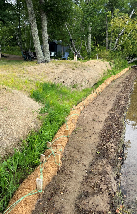
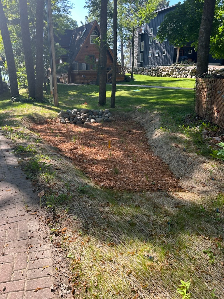
The first objective focused on Best Management Practive Installation. This objective worked with individual landowners in four major area – farm, lakeshore, stormwater and forestry. Working with the agricultural producers was a challenge. We were not able to complete any practices, but instead focused on building relationships that will help us in the future. We partnered with 15 differnet shoreline property owners to stabilize their banks through the installation of rock rip rap, coir logs, and native vegetation. Stormwater was controlled at two different sites through the installation of rain gardens and vegetated swales. Five forest stewardship plans were written in the watershed, providing management suggestions for protecting water quality on 752 acres.
Education and outreach activities were another focus. Through this objective we were able to host 9 different workshops for shoreline property owners, contractors, realtors, agricultural producers, community members and more. Participants in these gatherings totaled 212. Direct mailings and newsletters were also part of this objective.
Major partners in this effort include the Aitkin and Carlton Soil and Water Conservation Districts, Technical Service Area 3 Engineers, and the Big Sandy Area Lakes Watershed Management Project volunteers. We are excited to continue these partnerships and build on the success of Phase 1 as we move into Phase 2 of this effort.